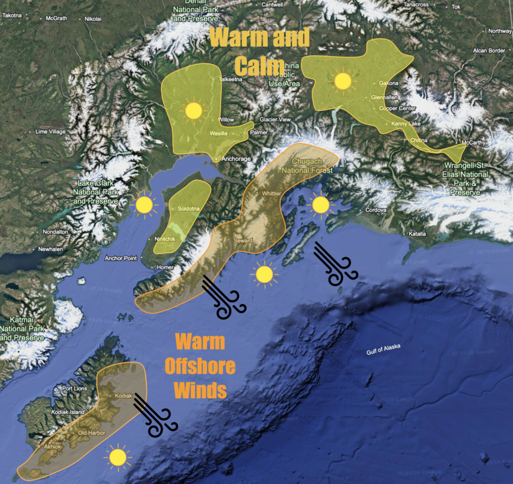
That late August cold front definitely felt like an early start to fall. Despite that, summer-like weather is coming back. Last week, we almost hit 70 three times in Palmer. A little cooler weather and rain came through, but this week looks like the return of warm temperatures. Starting Wednesday, the 9th, temperatures warm up and clouds clear out across the region. A ridge of high pressure will set itself up over the region, allowing for unusually warm sunny weather. Highs across interior regions will be in the mid to upper 60s. Interior areas such as the MatSu and Copper River Basin may hit 70. Clear skies will allow lows to fall into the low 40s for most, with some further inland or higher elevation areas dropping into the 30s. Morning fog is also possible due to strong radiational cooling.
Along the coast, temperatures will be warm as well. Places such as Kodiak, Seward, and Whittier will start off this stretch with blustery northwest winds bringing clear and warm conditions. The down sloping nature of these winds will produce highs in the mid to upper 60s, with some areas nearing or hitting 70. As the strong northwest flow degrades by Thursday, coastal areas will remain mostly sunny, but with cooler temperatures as sea breezes will return. Inland areas will remain sunny and warm. Saturday looks to be the last sunny and warm day as a slow moving arctic front approaches from the northwest, bringing a pattern shift to much cooler fall-like weather.