
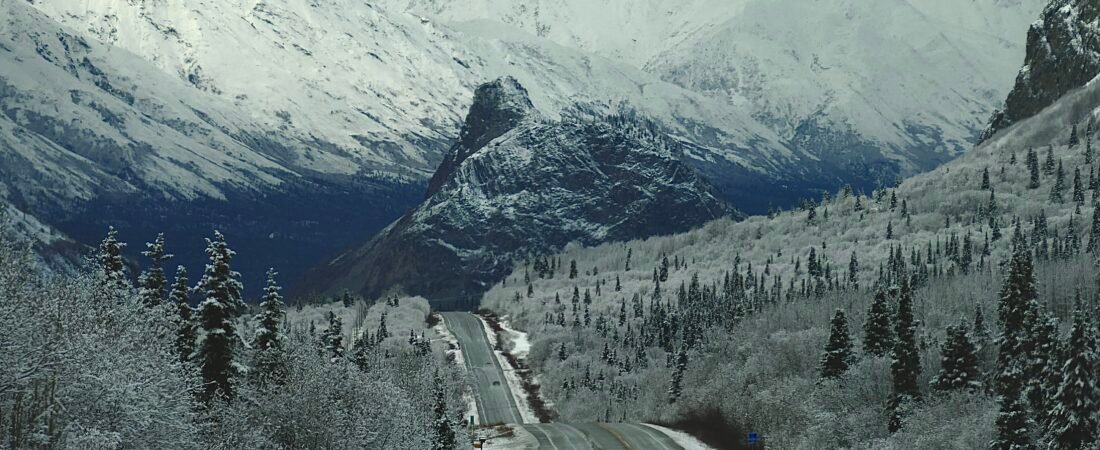
I have made some minor adjustments that trend colder, but overall the forecast remains largely on track. After weather that has been very typical of fall and very close to average, although maybe a touch windy, it is significantly colder now. Some areas are seeing their first snow right now. As of today (Wednesday), conditions are wet and somewhat wintery. Most areas have seen cold rain today, but slushy accumulation has managed to get down to the Copper River Basin, Wasilla, and Chugiak/Birchwood.
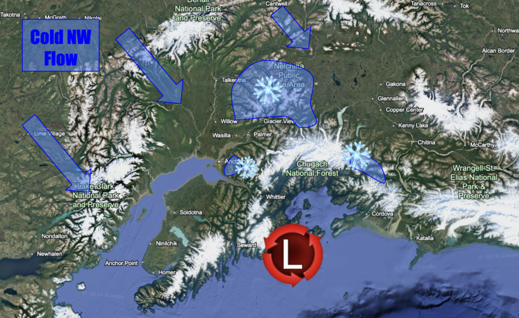
Colder temperatures than originally expected are prevailing which is what allowed for more slushy accumulation than expected for areas near sea level. Due to most areas already sitting in the mid 30s as of 5pm, I suspect temperatures will fall a few degrees during the night allowing for more widespread snow than originally expected. I don’t think everyone is going to get snow, but I do think areas in Anchorage along the Glenn, and around Palmer and Butte could see slushy accumulation into the overnight hours. I suspect snowfall amounts for these areas will stay under one inch, and fail to accumulate on roadways. There isn a different story for higher elevations. There will likely be 2-5 inches through Eureka and Thompson Pass, and upper parts of Anchorage and Eagle River Hillsides. The localized max for any of these areas will be 6 inches, especially if the system favors the GFS’ guidance where the system is slower to leave. Any snow that does fall in the passes will likely melt off the roads by day. Outside of that, the Copper River Basin could see an inch or two of snow overnight in some areas.
By Friday morning, it looks like there will be widespread lows below freezing for areas away from the coast. A brief ridge sets up Friday leading to calm sunny weather for most. For the coast, I just expect frequent rain and constant clouds throughout the event. The Susitna Valley will likely stay dry for the most part. As we get closer and high-resolution models continue to run this, I will keep updating this post. Below is a graphic of the overall pattern and the best chances for significant snow.
Updated 5:45 PM September 30th.