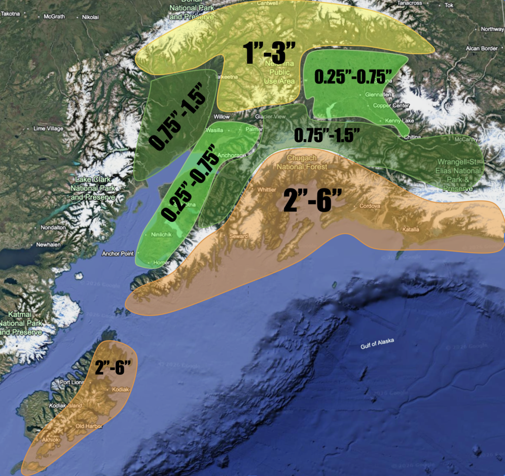
After a warmer start to September, it is starting to feel a lot more like fall, and temperatures are going to continue to drop. This weekend into next week will be characterized by clouds everywhere, significant amounts of coastal rain, and scattered rain showers inland. A persistent low pressure system sets up over the Prince William Sound through Tuesday. Storms will continue to track north bringing lots of rain along the coast, but inland areas will be more downsloped resulting in less rainfall for interior areas. I am expecting winds to be nothing major with this pattern, but not zero either. Cordova will likely see the most wind, with gusts possibly reaching 50 at times. Kodiak may reach into the 40s some, while other places along the coast will see wind gusts 30 or below. For the Western Kenai, gusts could reach into the 30s some of the time, especially close to the Cook Inlet. The Copper River Basin may see gusts around 30 as well, especially on Monday.
This system will also bring enough cold air to produce lower snow levels, down to around 2,000-3,000 ft. I would expect some snow to fall during the night in areas like Broad Pass, Eureka, and Isabel Pass, but accumulations will be light and melt quickly. By Wednesday, high pressure moves into the region bringing clear skies and cold nights with it, especially for interior areas, at least for a day or two. Wednesday and Thursday morning could bring frost into interior valleys, especially in the Copper River Basin. After that, models are beginning to agree on a rather strong low pressure entering the Bering Sea. Predicted rainfall amounts through Wednesday are below.